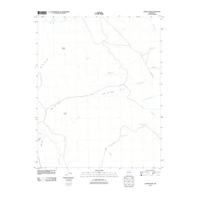
2010 Map of Cabezon Peak
USGS Topo · Published 2010About this map
Cabezon Peak dominates the northern horizon of this landscape, a prominent volcanic landmark in the high desert of Sandoval County. The drainage of the Rio Puerco carves through the southwestern portion of the map, fed by seasonal watercourses like Cañon Salado and Cañon Tapia. To the south, the massive landform of Mesa Prieta rises, its slopes marked by the winding Cañada Bonita. This area is defined by a network of ranching infrastructure and Bureau of Land Management routes, including N BLM 1114, which provide access to essential water sources such as Mesa Prieta Tank and Cabezon Tank Number 1. The terrain is deeply incised by Numerous arroyos, including Arroyo Alamo and Arroyo Cucho, illustrating the complex erosional patterns of this arid region.
Find a feature on this map
25 named features on this map. Tap any name to fly to it.
Don’t see what you’re looking for? This feature index may not catch every label — zoom into the map to look around manually.
Map Details
Editions of this 2010 Cabezon Peak Map
This is the sole edition of this map. No revisions or reprints were ever made.
Other maps of this area

1883 · Mt. Taylor
USGS Topo · 1:250,000

1886 · Mt. Taylor
USGS Topo · 1:250,000

1888 · Bernalillo
USGS Topo · 1:125,000

1889 · Albuquerque
USGS Topo · 1:125,000

1890 · Jemes
USGS Topo · 1:125,000

1892 · Jemes
USGS Topo · 1:125,000

1892 · Mt. Taylor
USGS Topo · 1:250,000

1893 · Albuquerque
USGS Topo · 1:125,000

1899 · Mt. Taylor
USGS Topo · 1:250,000

1939 · San Ysidro
USGS Topo · 1:62,500