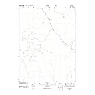
2011 Map of Cabin Creek
USGS Topo · Published 2011About this map
Willow Creek and its many mountain tributaries define the drainage patterns of this high-altitude landscape in Grand County. The map documents the intricate network of watercourses including Drowsy Water Creek, Adams Creek, and Cabin Creek, which flow through deep incisions like Sawmill Gulch. This 2011 survey reflects the area's dual character of recreation and historical extraction, evidenced by the Sawmill Gulch Campground and the Smith Creek Mine in the southeastern corner. A spiderweb of forest roads, such as Co RD 218 and Co RD 21, provides the primary access to these remote slopes. The concentration of family-named water features like McQueary Creek and Kinney Creek suggests a long history of ranching or homesteading in the valleys between the ridges.
Find a feature on this map
17 named features on this map. Tap any name to fly to it.
Don’t see what you’re looking for? This feature index may not catch every label — zoom into the map to look around manually.
Map Details
Editions of this 2011 Cabin Creek Map
This is the sole edition of this map. No revisions or reprints were ever made.
Other maps of this area

1915 · Longs Peak
USGS Topo · 1:125,000

1919 · Rocky Mountain National Park
USGS Topo · 1:125,000

1954 · Greeley
USGS Topo · 1:250,000

1954 · Craig
USGS Topo · 1:250,000

1956 · Radial Mountain
USGS Topo · 1:24,000

1956 · Parkview Mountain
USGS Topo · 1:24,000

1956 · Rand
USGS Topo · 1:62,500

1957 · Craig
USGS Topo · 1:250,000

1957 · Greeley
USGS Topo · 1:250,000

1957 · Bowen Mountain
USGS Topo · 1:24,000