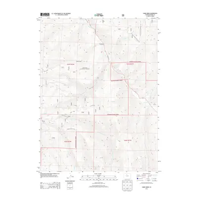
2013 Map of Cabin Creek
USGS Topo · Published 2013About this map
Arapaho National Forest dominates this high-altitude landscape in Grand County, where the topography is defined by the sharp elevations of McQueary Ridge and the drainages of the Colorado River basin. The map illustrates a network of primitive access routes and hiking paths, including the Little Gravel Mountain Road Trail 190.1 and Drowsy Water Trail 37, which navigate the steep terrain between Sawmill Gulch and the surrounding peaks. In the early 21st century, this area remains centered on recreation and forest management, anchored by the Sawmill Gulch Campground and the north-south corridor of State Hwy 125. Numerous seasonal streams, such as Buffalo Creek, Adams Cr, and Gold Run, carve through the forest, tracing the hydrologic patterns of the western slope.
Find a feature on this map
36 named features on this map. Tap any name to fly to it.
Don’t see what you’re looking for? This feature index may not catch every label — zoom into the map to look around manually.
Map Details
Editions of this 2013 Cabin Creek Map
This is the sole edition of this map. No revisions or reprints were ever made.
Other maps of this area

1915 · Longs Peak
USGS Topo · 1:125,000

1919 · Rocky Mountain National Park
USGS Topo · 1:125,000

1954 · Greeley
USGS Topo · 1:250,000

1954 · Craig
USGS Topo · 1:250,000

1956 · Radial Mountain
USGS Topo · 1:24,000

1956 · Parkview Mountain
USGS Topo · 1:24,000

1956 · Rand
USGS Topo · 1:62,500

1957 · Craig
USGS Topo · 1:250,000

1957 · Greeley
USGS Topo · 1:250,000

1957 · Bowen Mountain
USGS Topo · 1:24,000