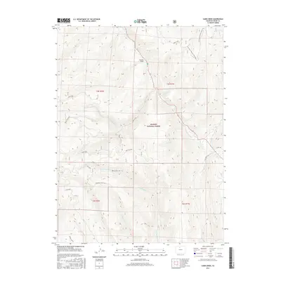
2016 Map of Cabin Creek
USGS Topo · Published 2016About this map
Arapaho National Forest dominates this high-elevation landscape in Grand County, where a complex network of drainage basins defines the topography. The headwaters of Cabin Creek and its various branches, including S Cabin Creek, N Fork Cabin Cr, and Middle Cabin Creek, carve through the terrain alongside other significant watercourses like Drowsy Water Cr and Kinney Cr. The distribution of named trails and points of interest suggests a landscape managed for both timber and recreation.
Find a feature on this map
27 named features on this map. Tap any name to fly to it.
Don’t see what you’re looking for? This feature index may not catch every label — zoom into the map to look around manually.
Map Details
Editions of this 2016 Cabin Creek Map
This is the sole edition of this map. No revisions or reprints were ever made.
Other maps of this area

1915 · Longs Peak
USGS Topo · 1:125,000

1919 · Rocky Mountain National Park
USGS Topo · 1:125,000

1954 · Greeley
USGS Topo · 1:250,000

1954 · Craig
USGS Topo · 1:250,000

1956 · Radial Mountain
USGS Topo · 1:24,000

1956 · Parkview Mountain
USGS Topo · 1:24,000

1956 · Rand
USGS Topo · 1:62,500

1957 · Craig
USGS Topo · 1:250,000

1957 · Greeley
USGS Topo · 1:250,000

1957 · Bowen Mountain
USGS Topo · 1:24,000