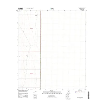
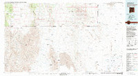
2013 Map of Cabin Wells
USGS Topo · Published 2013About this map
The international border between New Mexico and Chihuahua, Mexico defines the central axis of this landscape, where the high desert terrain of Hachita Valley spans across Hidalgo County. The map documents a sparse ranching and boundary environment, marked primarily by the presence of Cabin Wells and the water source at Mengus Tank. A single primary transit artery, Commodore Rd, traverses the western half of the quadrangle through the Public Land Survey System sections of t31s r14w and t32s r14w. This 2013 survey illustrates the modern isolation of the borderlands, where the landscape remains largely undeveloped except for these critical water and transit points.
Find a feature on this map
10 named features on this map. Tap any name to fly to it.
Don’t see what you’re looking for? This feature index may not catch every label — zoom into the map to look around manually.
Map Details
Editions of this 2013 Cabin Wells Map
This is the sole edition of this map. No revisions or reprints were ever made.
Other maps of this area

1918 · Big Hatchet Peak
USGS Topo · 1:62,500

1918 · Dog Mountains
USGS Topo · 1:62,500

1955 · Douglas
USGS Topo · 1:250,000

1959 · Douglas
USGS Topo · 1:250,000

1961 · Douglas
USGS Topo · 1:250,000

1964 · Douglas
USGS Topo · 1:250,000
1982 · Sheridan Canyon
USGS Topo · 1:24,000
1982 · Pierce Peak
USGS Topo · 1:24,000
1982 · Hatchet Ranch
USGS Topo · 1:24,000
1983 · Alamo Hueco Mountains
USGS Topo · 1:100,000