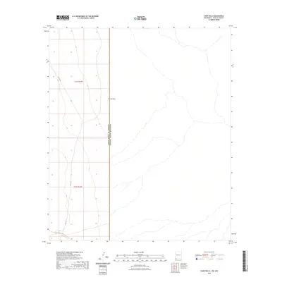
2023 Map of Cabin Wells
USGS Topo · Published 2023About this map
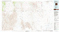
The international boundary between the United States of America and Mexico bisects this section of Hidalgo County, marking a stark geopolitical division across the arid landscape of the Hachita Valley. To the west, the terrain is traversed by the long-distance Continental Divide National Scenic Trail, which winds through the high desert alongside the remote path of Co RD c119. This 2023 survey illustrates the intersection of a major recreational corridor with the sensitive border region, where the open valley floor meets the administrative lines of t31s r14w and t32s r14w. The map provides a contemporary perspective on this sparsely populated corner of the American Southwest, where topographic contours define the drainage patterns and rugged accessibility of the high Chihuahuan Desert.
Find a feature on this map
6 named features on this map. Tap any name to fly to it.
Don’t see what you’re looking for? This feature index may not catch every label — zoom into the map to look around manually.
Map Details
Editions of this 2023 Cabin Wells Map
This is the sole edition of this map. No revisions or reprints were ever made.
Other maps of this area

1918 · Big Hatchet Peak
USGS Topo · 1:62,500

1918 · Dog Mountains
USGS Topo · 1:62,500

1955 · Douglas
USGS Topo · 1:250,000

1959 · Douglas
USGS Topo · 1:250,000

1961 · Douglas
USGS Topo · 1:250,000

1964 · Douglas
USGS Topo · 1:250,000
1982 · Sheridan Canyon
USGS Topo · 1:24,000
1982 · Pierce Peak
USGS Topo · 1:24,000
1982 · Hatchet Ranch
USGS Topo · 1:24,000
1983 · Alamo Hueco Mountains
USGS Topo · 1:100,000