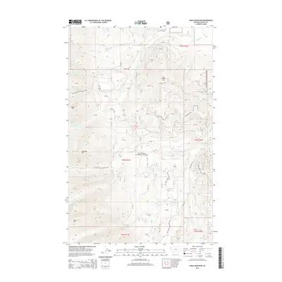
2014 Map of Cable Mountain
USGS Topo · Published 2014About this map
Kootenai National Forest dominates this section of northwestern Montana, where a complex network of forest roads and mountain drainages defines the backcountry. The landscape is punctuated by prominent peaks including Big Hoodoo Mtn, McDonald Mtn, and Cable Mtn, which serve as anchors for the surrounding watershed. Numerous creeks, such as Snowshoe Cr, Crazyman Cr, and Little Cherry Cr, carve through the terrain, feeding into larger systems like Libby Cr. The presence of established routes like Cherry Creek Rd and Libby Creek Rd highlights the long-standing importance of this area for timber access and resource management. For researchers, the map provides a clear view of the drainage patterns and the specific naming conventions used for the ridges and valleys that have guided local navigation for decades.
Find a feature on this map
37 named features on this map. Tap any name to fly to it.
Don’t see what you’re looking for? This feature index may not catch every label — zoom into the map to look around manually.
Map Details
Editions of this 2014 Cable Mountain Map
This is the sole edition of this map. No revisions or reprints were ever made.
Other maps of this area

1920 · Libby
USGS Topo · 1:125,000

1920 · Jennings
USGS Topo · 1:125,000

1930 · Libby
USGS Topo · 1:125,000

1932 · Libby
USGS Topo · 1:125,000

1935 · Thompson Lakes
USGS Topo · 1:96,000

1942 · Thompson Lakes
USGS Topo · 1:125,000

1957 · Kalispell
USGS Topo · 1:250,000

1960 · Kalispell
USGS Topo · 1:250,000

1961 · Kalispell
USGS Topo · 1:250,000

1963 · Swede Mountain
USGS Topo · 1:24,000