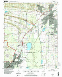
1994 Map of Cabot
USGS Topo · Published 2000About this map
Cabot and Jacksonville anchor this mid-1990s landscape, a period marked by residential expansion alongside significant military and conservation footprints. The southwestern portion is dominated by the Little Rock Air Force Base, while the central and eastern sectors feature the expansive Holland Bottoms State Wildlife Management Area and Pickthorne Lake. This survey illustrates the transition from the ridge-top settlements of Backbone Ridge and Mill Ridge to the low-lying Ford Bottoms.
Find a feature on this map
62 named features on this map. Tap any name to fly to it.
Don’t see what you’re looking for? This feature index may not catch every label — zoom into the map to look around manually.
Map Details
Editions of this 1994 Cabot Map
This is the sole edition of this map. No revisions or reprints were ever made.
Other maps of this area

1891 · Little Rock
USGS Topo · 1:125,000

1893 · Little Rock
USGS Topo · 1:125,000

1935 · Mc Almont
USGS Topo · 1:24,000

1940 · Lonoke
USGS Topo · 1:62,500

1941 · Olmstead
USGS Topo · 1:31,680

1941 · Cabot
USGS Topo · 1:31,680

1943 · Jacksonville
USGS Topo · 1:31,680

1948 · Helena
USGS Topo · 1:250,000

1949 · Lonoke
USGS Topo · 1:62,500

1950 · Helena
USGS Topo · 1:250,000