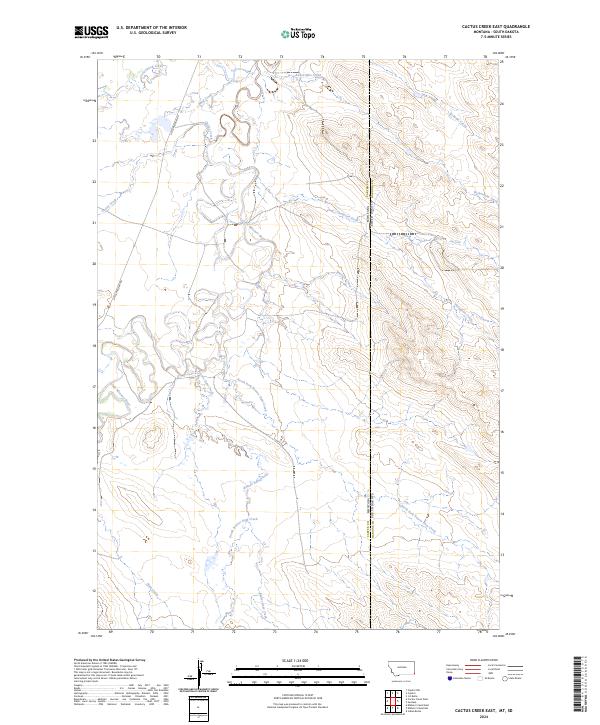
2024 Map of Cactus Creek East
USGS Topo · Published 2024About this map
The Little Missouri River carves a winding path through this corner of Carter County, where the state line meets Harding County, South Dakota. The drainage patterns here are complex, defined by a dense network of seasonal tributaries including Beaver Dam Creek, North Fork Beaver Dam Creek, and South Beaver Dam Creek. This landscape is primarily accessed by Little Missouri Rd, which runs parallel to the river's western bank through the various sections of the Public Land Survey System. The map documents numerous smaller watercourses such as Cactus Creek and Thompson Creek that drain into the larger river valley, illustrating the high-plains hydrology of the region. This 2024 survey captures the area's current configuration of range roads and natural landmarks as they exist today.
Find a feature on this map
21 named features on this map. Tap any name to fly to it.
Don’t see what you’re looking for? This feature index may not catch every label — zoom into the map to look around manually.
Map Details
Editions of this 2024 Cactus Creek East Map
This is the sole edition of this map. No revisions or reprints were ever made.
Other maps of this area

1935 · Harding
USGS Topo · 1:125,000

1954 · Lemmon
USGS Topo · 1:250,000

1954 · Ekalaka
USGS Topo · 1:250,000

1956 · Ekalaka
USGS Topo · 1:250,000

1957 · Lemmon
USGS Topo · 1:250,000

1958 · Ekalaka
USGS Topo · 1:250,000

1965 · Ekalaka
USGS Topo · 1:250,000
1978 · J K Butte
USGS Topo · 1:24,000
1978 · Indian Butte
USGS Topo · 1:24,000
1978 · Gustave
USGS Topo · 1:24,000