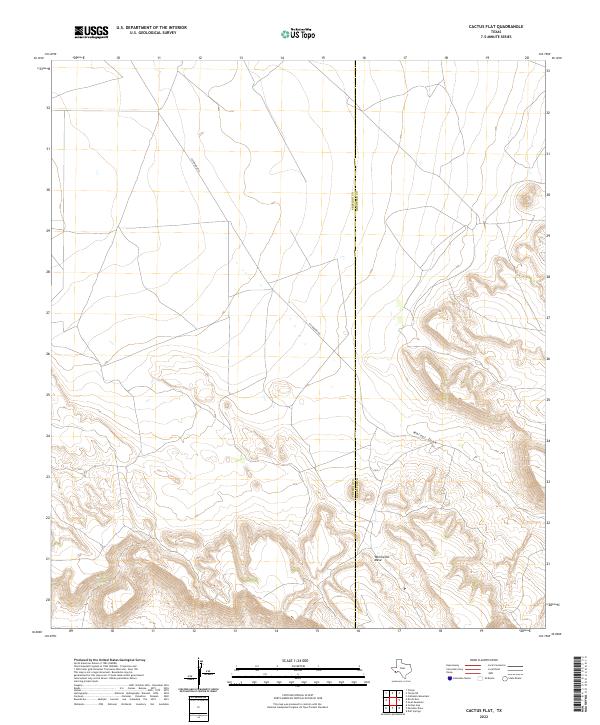
2022 Map of Cactus Flat
USGS Topo · Published 2022About this map
Whirlwind Mesa dominates the southern landscape of this West Texas terrain, where the high desert plateau meets the deeply incised drainage of Walnut Draw. The map documents a sparsely populated area defined by the shared boundary between Presidio and Brewster Counties. This line runs through a region where physical geography dictates human movement, as seen in the path of Escondido Rd, the primary corridor through the flats. The detailed contour work illustrates the transition from broad, open plains to the complex, eroded escarpments of the mesa, providing a clear record of the area's hydrology and land-use patterns near the turn of the 21st century.
Find a feature on this map
4 named features on this map. Tap any name to fly to it.
Don’t see what you’re looking for? This feature index may not catch every label — zoom into the map to look around manually.
Map Details
Editions of this 2022 Cactus Flat Map
This is the sole edition of this map. No revisions or reprints were ever made.
Other maps of this area

1895 · Alpine
USGS Topo · 1:125,000

1917 · Buck Hill
USGS Topo · 1:62,500

1918 · Buck Hill
USGS Topo · 1:62,500

1918 · Jordan Gap
USGS Topo · 1:62,500

1925 · Buck Hill
USGS Topo · 1:62,500

1930 · Jordan Gap
USGS Topo · 1:62,500

1954 · Fort Stockton
USGS Topo · 1:250,000

1958 · Fort Stockton
USGS Topo · 1:250,000

1959 · Emory Peak
USGS Topo · 1:250,000

1965 · Emory Peak
USGS Topo · 1:250,000