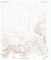
1983 Map of Cactus Flat
USGS Topo · Published 1983About this map
Cactus Flat and the surrounding high desert terrain of the Big Bend region are defined by a complex network of plateaus and steep drainage features. The landscape is dominated by significant elevations such as Whirlwind Mesa and Mitchell Mesa, which are carved by seasonal watercourses like Walnut and the evocatively named Bootlegger Canyon. Human presence is sparse but concentrated at established cattle operations, specifically the Crosson Ranch and Escondido Ranch.
Find a feature on this map
18 named features on this map. Tap any name to fly to it.
Don’t see what you’re looking for? This feature index may not catch every label — zoom into the map to look around manually.
Map Details
Editions of this 1983 Cactus Flat Map
This is the sole edition of this map. No revisions or reprints were ever made.
Other maps of this area

1895 · Alpine
USGS Topo · 1:125,000

1917 · Buck Hill
USGS Topo · 1:62,500

1918 · Buck Hill
USGS Topo · 1:62,500

1918 · Jordan Gap
USGS Topo · 1:62,500

1925 · Buck Hill
USGS Topo · 1:62,500

1930 · Jordan Gap
USGS Topo · 1:62,500

1954 · Fort Stockton
USGS Topo · 1:250,000

1958 · Fort Stockton
USGS Topo · 1:250,000

1959 · Emory Peak
USGS Topo · 1:250,000

1965 · Emory Peak
USGS Topo · 1:250,000