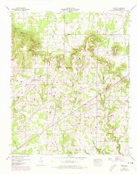
1948 Map of Caddo
USGS Topo · Published 1973About this map
Caddo serves as a small rural hub in Lawrence County, Alabama, surrounded by a landscape defined by significant topographic relief and numerous family-named landmarks. The terrain transitions from the elevations of Chicken Foot Mountain and Bates Mountain in the northwest to the complex drainage systems of Shoals Creek and its branches in the south. The area is dotted with small country churches that served as community anchors, including New Antioch Ch, Harmony Ch, and Sulphur Springs Church. Many of these congregations are paired with local burial grounds like the Sivley Cem and Vaughan Cem, providing a detailed record for genealogical research. The presence of Midway Sch and distinctive natural features like Goat Bluff and Penitentiary Hole suggests a well-established, though dispersed, rural society. The northern edge of the map is clipped by the Southern railroad, hinting at the transport links connecting this highland region to the broader Tennessee Valley.
Find a feature on this map
69 named features on this map. Tap any name to fly to it.
Don’t see what you’re looking for? This feature index may not catch every label — zoom into the map to look around manually.
Map Details
Editions of this 1948 Caddo Map
This is the sole edition of this map. No revisions or reprints were ever made.
Other maps of this area

1935 · Moulton
USGS Topo · 1:24,000

1935 · Danville
USGS Topo · 1:48,000

1935 · Oakville
USGS Topo · 1:24,000

1936 · Caddo
USGS Topo · 1:24,000

1936 · Stewart Cross Roads
USGS Topo · 1:24,000

1936 · Courtland
USGS Topo · 1:24,000

1936 · Trinity
USGS Topo · 1:24,000

1936 · Hillsboro
USGS Topo · 1:24,000

1936 · Moulton
USGS Topo · 1:48,000

1936 · Masterson
USGS Topo · 1:24,000