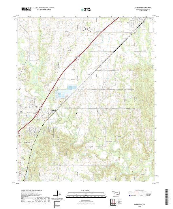
2022 Map of Caddo South
USGS Topo · Published 2022About this map
Caddo and the northern outskirts of Durant anchor this survey of the Bryan County landscape, where the Blue River and its numerous tributaries like Johnson Cr and Thompson Cr carve through the rolling terrain. The map documents a blend of rural residential growth and long-standing agricultural land, centered around the path of the dual Highway 69/75 corridor. Genealogists and local historians will find value in the precise locations of the Brown Cem and Pleasant Hill Cem, as well as named locales such as Armstrong and Wasseta. The inclusion of the Tomahawk Airport and the Wasetta Switch reflects the infrastructure supporting this portion of southern Oklahoma. From the residential streets of Ury to the seasonal waters of Simmons Lake, the sheet provides a clear record of property boundaries and local landmarks south of the Red River valley.
Find a feature on this map
65 named features on this map. Tap any name to fly to it.
Don’t see what you’re looking for? This feature index may not catch every label — zoom into the map to look around manually.
Map Details
Editions of this 2022 Caddo South Map
This is the sole edition of this map. No revisions or reprints were ever made.
Other maps of this area

1899 · Atoka
USGS Topo · 1:125,000

1900 · Atoka
USGS Topo · 1:125,000

1954 · Sherman
USGS Topo · 1:250,000

1957 · Wade
USGS Topo · 1:62,500

1957 · Ardmore
USGS Topo · 1:250,000

1958 · Durant
USGS Topo · 1:62,500

1958 · Sherman
USGS Topo · 1:250,000

1963 · Ardmore
USGS Topo · 1:250,000

1968 · Caddo NW
USGS Topo · 1:24,000
1968 · Durant North
USGS Topo · 1:24,000