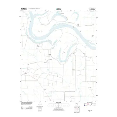
2011 Map of Cades
USGS Topo · Published 2011About this map
The Arkansas River carves a dramatic, winding course through this Lincoln County landscape, defining its settlement patterns and natural boundaries. Major river features like Cummins Bend, Lake Bend, and Sloan Island reveal the river's historical shifting path, while Douglas Old River Lake and Douglas Cut Off show the remnants of old channels. This area is noted for the significant presence of the State Penal Farm Number 2 near Cummins, a major regional facility that has long influenced the local infrastructure and land use.
Find a feature on this map
40 named features on this map. Tap any name to fly to it.
Don’t see what you’re looking for? This feature index may not catch every label — zoom into the map to look around manually.
Map Details
Editions of this 2011 Cades Map
This is the sole edition of this map. No revisions or reprints were ever made.
Other maps of this area

1935 · Varner
USGS Topo · 1:62,500

1935 · Rotan
USGS Topo · 1:62,500

1935 · Red Fork
USGS Topo · 1:62,500

1935 · Gillett
USGS Topo · 1:62,500

1948 · Helena
USGS Topo · 1:250,000

1950 · Helena
USGS Topo · 1:250,000

1953 · Greenwood
USGS Topo · 1:250,000

1955 · Helena
USGS Topo · 1:250,000

1956 · Greenwood
USGS Topo · 1:250,000

1959 · Helena
USGS Topo · 1:250,000