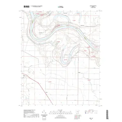
2020 Map of Cades
USGS Topo · Published 2020About this map
Cummins Bend and Sloan Island define the winding course of the Arkansas River as it snakes through the alluvial lowlands of Lincoln and Jefferson counties. This landscape is a complex network of oxbows and secondary waterways, featuring prominent abandoned channels like Douglas Old River Lake and Douglas Cut-Off. The settlement pattern reflects the area's agricultural and riverine history, with small communities such as Douglas, Varner, and Cades dispersed across the flat plains. For genealogists, the map is particularly valuable for its documentation of rural burial sites, including Rice Cem near Varner and Douglas Cem located east of Oakwood Bayou. The road network, including State Hwy 114 and various county roads, follows the section lines of the Public Land Survey System, illustrating how 20th-century transportation infrastructure adapted to the historic grid of the Arkansas Delta.
Find a feature on this map
48 named features on this map. Tap any name to fly to it.
Don’t see what you’re looking for? This feature index may not catch every label — zoom into the map to look around manually.
Map Details
Editions of this 2020 Cades Map
This is the sole edition of this map. No revisions or reprints were ever made.
Other maps of this area

1935 · Varner
USGS Topo · 1:62,500

1935 · Rotan
USGS Topo · 1:62,500

1935 · Red Fork
USGS Topo · 1:62,500

1935 · Gillett
USGS Topo · 1:62,500

1948 · Helena
USGS Topo · 1:250,000

1950 · Helena
USGS Topo · 1:250,000

1953 · Greenwood
USGS Topo · 1:250,000

1955 · Helena
USGS Topo · 1:250,000

1956 · Greenwood
USGS Topo · 1:250,000

1959 · Helena
USGS Topo · 1:250,000