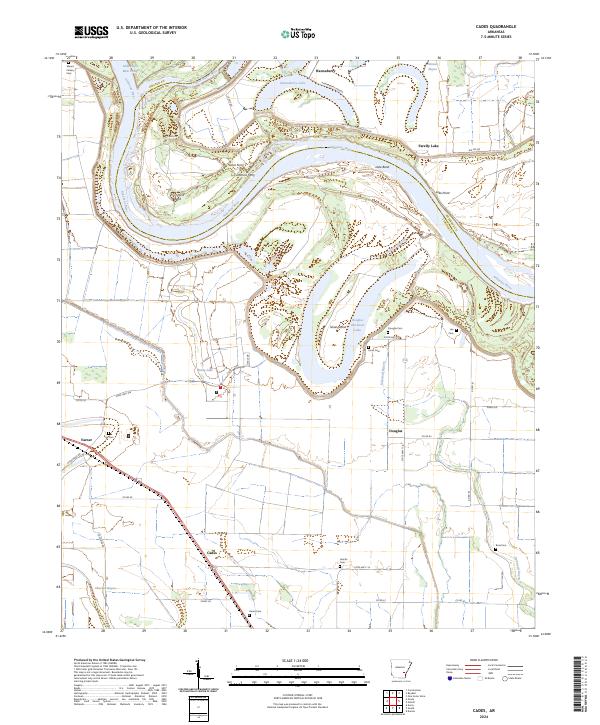
2024 Map of Cades
USGS Topo · Published 2024About this map
Arkansas River meanders define the northern landscape of this Lincoln County region, where the river's shifting path has created distinct oxbow features like Douglas Old River Lake and Hannaberry Lake. The terrain is marked by significant engineering efforts to manage these waterways, evidenced by the Douglas Cut-Off and the Little Bayou Meto Cutoff. These alterations to the natural flow reflect the long-standing agricultural and navigational requirements of the Delta region.
Find a feature on this map
50 named features on this map. Tap any name to fly to it.
Don’t see what you’re looking for? This feature index may not catch every label — zoom into the map to look around manually.
Map Details
Editions of this 2024 Cades Map
This is the sole edition of this map. No revisions or reprints were ever made.
Other maps of this area

1935 · Varner
USGS Topo · 1:62,500

1935 · Rotan
USGS Topo · 1:62,500

1935 · Red Fork
USGS Topo · 1:62,500

1935 · Gillett
USGS Topo · 1:62,500

1948 · Helena
USGS Topo · 1:250,000

1950 · Helena
USGS Topo · 1:250,000

1953 · Greenwood
USGS Topo · 1:250,000

1955 · Helena
USGS Topo · 1:250,000

1956 · Greenwood
USGS Topo · 1:250,000

1959 · Helena
USGS Topo · 1:250,000