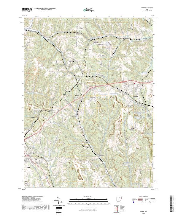
2023 Map of Cadiz
USGS Topo · Published 2023About this map
The Harrison County Courthouse serves as the focal point of Cadiz, the county seat, in a landscape defined by the legacies of the coal industry and long-established rural communities. The map details several coal-related water features, including multiple Consolidation Coal Company Ponds and Jeffco Ponds, which illustrate the industrial footprint on the local terrain. Small settlements like Unionvale, East Cadiz, and Skit are linked by a complex network of county and township roads such as the Jewett Hopedale Rd and the W & Le RR. Genealogists will find significant value in the numerous burial grounds documented, from the Old Cadiz Cem to the Beech Spring Cem and Blue Ridge Cem. The area’s varied topography includes the Blue Ridge and Rose Valley, where creeks like Cross Creek and Conotton Creek have historically shaped the settlement patterns of this corner of eastern Ohio.
Find a feature on this map
122 named features on this map. Tap any name to fly to it.
Don’t see what you’re looking for? This feature index may not catch every label — zoom into the map to look around manually.
Map Details
Editions of this 2023 Cadiz Map
This is the sole edition of this map. No revisions or reprints were ever made.
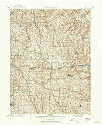
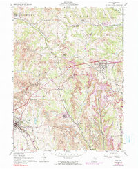
Historical Maps of Cadiz Through Time
4 maps found