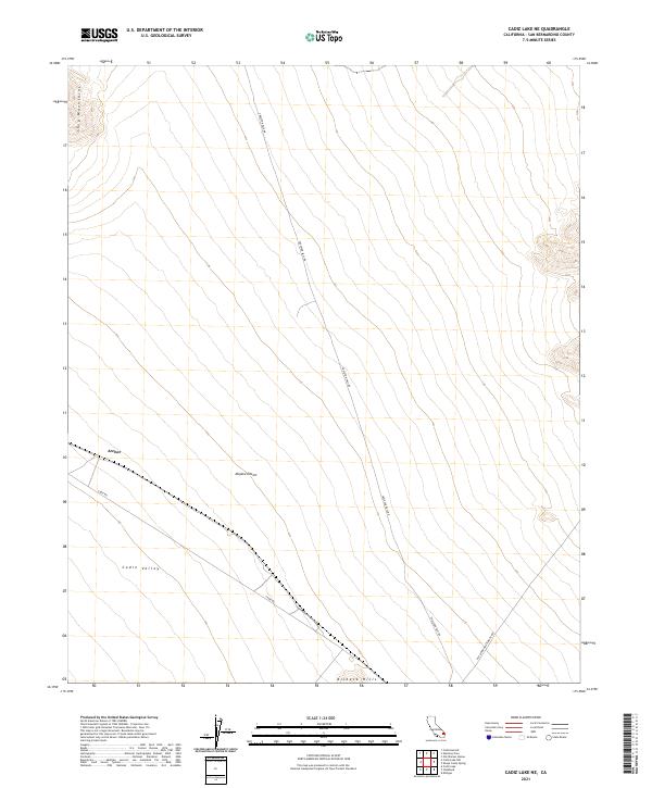
2021 Map of Cadiz Lake NE
USGS Topo · Published 2021About this map
The settlement of Archer sits at the base of the Ship Mountains in this high-desert portion of the Mojave Desert. The landscape is defined by broad alluvial basins and isolated mountain ranges, with the Cadiz Valley occupying the southern portion of the map. Travel through this arid region relies on a network of unpaved desert routes, most notably Skeleton Pass Rd, which cuts north-to-south through the center of the survey. The southern boundary is marked by the rising slopes of the Kilbeck Hills. This map documents the essential desert infrastructure of San Bernardino County, where long-distance roads like Cadiz Rd and the curiously named Old Woman Meteorite Rd provide the only access across these expansive valleys. The lack of modern development highlight's the area's preservation of its early 20th-century character as a remote corridor between mountain ranges.
Find a feature on this map
14 named features on this map. Tap any name to fly to it.
Don’t see what you’re looking for? This feature index may not catch every label — zoom into the map to look around manually.
Map Details
Editions of this 2021 Cadiz Lake NE Map
This is the sole edition of this map. No revisions or reprints were ever made.
Other maps of this area

1942 · Amboy
USGS Topo · 1:250,000

1943 · Amboy
USGS Topo · 1:250,000

1943 · Essex
USGS Topo · 1:62,500

1943 · Danby
USGS Topo · 1:62,500

1943 · Cadiz Lake
USGS Topo · 1:62,500

1954 · Needles
USGS Topo · 1:250,000

1956 · Needles
USGS Topo · 1:250,000

1956 · Milligan
USGS Topo · 1:62,500

1956 · Essex
USGS Topo · 1:62,500

1956 · Cadiz Lake
USGS Topo · 1:62,500