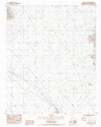
1985 Map of Cadiz Lake NE
USGS Topo · Published 1985About this map
Ship Mountains and the Old Woman Mountains frame a wide desert expanse centered on the Cadiz Valley in the mid-1980s. This arid landscape is punctuated by infrastructure for water and resource extraction, including the Rice Well No 1 and various prospects near the Kilbeck Hills. The settlement at Archer is marked by a small Cem and a nearby Test Well, while Levees suggest managed drainage through the alluvial flats. Small-scale industrial activity is further evidenced by a site at Milligan, located at the base of the eastern peaks. The terrain is defined by dry drainage patterns like Browns Wash, showing the natural hydrology of the Mojave before modern development altered these remote basins.
Find a feature on this map
22 named features on this map. Tap any name to fly to it.
Don’t see what you’re looking for? This feature index may not catch every label — zoom into the map to look around manually.
Map Details
Editions of this 1985 Cadiz Lake NE Map
This is the sole edition of this map. No revisions or reprints were ever made.
Other maps of this area

1942 · Amboy
USGS Topo · 1:250,000

1943 · Amboy
USGS Topo · 1:250,000

1943 · Essex
USGS Topo · 1:62,500

1943 · Danby
USGS Topo · 1:62,500

1943 · Cadiz Lake
USGS Topo · 1:62,500

1954 · Needles
USGS Topo · 1:250,000

1956 · Needles
USGS Topo · 1:250,000

1956 · Milligan
USGS Topo · 1:62,500

1956 · Essex
USGS Topo · 1:62,500

1956 · Cadiz Lake
USGS Topo · 1:62,500