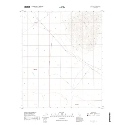
2018 Map of Cadiz Lake NW
USGS Topo · Published 2018About this map
Ship Mountains rise sharply in the northeastern corner of this map, dominating the topography where the peaks overlook the wide expanse of the Mojave Desert. The landscape is defined by the drainage patterns of Watson Wash, which flows southward through the basin. This arid region of San Bernardino County shows a primitive infrastructure of desert travel, primarily centered on Cadiz Rd and Cadiz Dunes Rd. These routes cut through the Cadiz Valley, illustrating the sparse and isolated character of this part of the California interior. The map clearly delineates the township and range boundaries, including t5n r15e and t4n r14e, providing an essential reference for land ownership and historical property research in the high desert.
Find a feature on this map
12 named features on this map. Tap any name to fly to it.
Don’t see what you’re looking for? This feature index may not catch every label — zoom into the map to look around manually.
Map Details
Editions of this 2018 Cadiz Lake NW Map
This is the sole edition of this map. No revisions or reprints were ever made.
Other maps of this area

1942 · Amboy
USGS Topo · 1:250,000

1943 · Amboy
USGS Topo · 1:250,000

1943 · Danby
USGS Topo · 1:62,500

1943 · Cadiz Lake
USGS Topo · 1:62,500

1954 · Needles
USGS Topo · 1:250,000

1956 · Needles
USGS Topo · 1:250,000

1956 · Bristol Lake
USGS Topo · 1:62,500

1956 · Cadiz Lake
USGS Topo · 1:62,500

1956 · Cadiz
USGS Topo · 1:62,500

1956 · Danby
USGS Topo · 1:62,500