
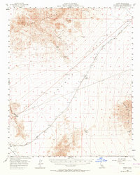
1956 Map of Danby
USGS Topo · Published 1958About this map
Mining operations and railroad infrastructure dominate this Mojave Desert landscape during the mid-1950s. The Atchison Topeka and Santa Fe railroad serves as the primary corridor for regional movement, connecting small desert outposts like Chambless, Danby, and Siam. In the more elevated terrain, industrial activity is evident at the Vulcan Mine and the Tom Reed Mine, while numerous shafts, tunnels, and prospects are scattered through the Ship Mountains and Clipper Mountains. Water, a critical resource in this arid environment, is noted at Bonanza Spring and specific Wells. The inclusion of an Airway Beacon near Cadiz Summit highlights the importance of this territory to early mid-century aviation routes. The map effectively captures a network of jeep trails and pipelines that supported the remote extraction economy of San Bernardino County.
Find a feature on this map
31 named features on this map. Tap any name to fly to it.
Don’t see what you’re looking for? This feature index may not catch every label — zoom into the map to look around manually.
Map Details
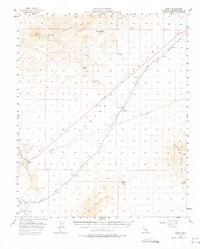
Editions of this 1956 Danby Map
3 editions found
Other maps of this area

1942 · Amboy
USGS Topo · 1:250,000

1943 · Amboy
USGS Topo · 1:250,000

1943 · Essex
USGS Topo · 1:62,500

1943 · Danby
USGS Topo · 1:62,500

1943 · Cadiz Lake
USGS Topo · 1:62,500

1943 · Fenner
USGS Topo · 1:62,500

1954 · Needles
USGS Topo · 1:250,000

1956 · Needles
USGS Topo · 1:250,000

1956 · Milligan
USGS Topo · 1:62,500

1956 · Fenner
USGS Topo · 1:62,500