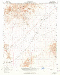
1956 Map of Danby
USGS Topo · Published 1964About this map
The Atchison Topeka and Santa Fe railroad serves as the industrial backbone of this Mojave Desert landscape, connecting a string of remote outposts and sidings. Small settlements and points of interest like Chambless, Danby, Siam, and Cadiz are scattered along the rail corridor and the highway passing through Cadiz Summit. The terrain is defined by dramatic mountain ranges, including the Clipper Mountains and the Ship Mountains, which hem in the broad expanse of Fenner Valley.
Find a feature on this map
28 named features on this map. Tap any name to fly to it.
Don’t see what you’re looking for? This feature index may not catch every label — zoom into the map to look around manually.
Map Details
Editions of this 1956 Danby Map
3 editions found

Other maps of this area

1942 · Amboy
USGS Topo · 1:250,000

1943 · Amboy
USGS Topo · 1:250,000

1943 · Essex
USGS Topo · 1:62,500

1943 · Danby
USGS Topo · 1:62,500

1943 · Cadiz Lake
USGS Topo · 1:62,500

1943 · Fenner
USGS Topo · 1:62,500

1954 · Needles
USGS Topo · 1:250,000

1956 · Needles
USGS Topo · 1:250,000

1956 · Milligan
USGS Topo · 1:62,500

1956 · Fenner
USGS Topo · 1:62,500