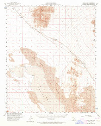
1956 Map of Cadiz Lake
USGS Topo · Published 1964About this map
Atchison Topeka and Santa Fe railroad tracks slice diagonally through this high desert basin, connecting the small stop at Archer to the settlement at Chubbuck. This mid-century survey reveals a landscape of stark contrasts, where the expansive Cadiz Lake playa and shifting Sand Dunes are bordered by the sharp rises of the Ship Mts and Kilbeck Hills.
Find a feature on this map
16 named features on this map. Tap any name to fly to it.
Don’t see what you’re looking for? This feature index may not catch every label — zoom into the map to look around manually.
Map Details
Editions of this 1956 Cadiz Lake Map
2 editions found

Other maps of this area

1942 · Amboy
USGS Topo · 1:250,000

1943 · Amboy
USGS Topo · 1:250,000

1943 · Essex
USGS Topo · 1:62,500

1943 · Danby
USGS Topo · 1:62,500

1943 · Cadiz Lake
USGS Topo · 1:62,500

1943 · Cadiz Valley
USGS Topo · 1:62,500

1943 · Iron Mountains
USGS Topo · 1:62,500

1954 · Needles
USGS Topo · 1:250,000

1956 · Needles
USGS Topo · 1:250,000

1956 · Milligan
USGS Topo · 1:62,500