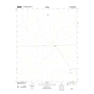
2012 Map of Cadiz
USGS Topo · Published 2012About this map
The Marble Mountains dominate the northern landscape of this Mojave Desert region, where the historic National Trails Hwy provides the primary east-west corridor through the settlement of Chambless. This 2012 survey illustrates the desert infrastructure of San Bernardino County, centered on the intersection of the highway and Mac Tul Rd. The landscape is defined by vast drainage systems like Cadiz Wash, which flows toward the southern flats near Cadiz Rd. To the southeast, the Cadiz Airstrip represents the area's specialized transportation needs, isolated within the arid terrain. The map's layout reflects a classic desert settlement pattern, where narrow ribbons of transit and aviation hubs connect remote outposts across the alluvial fans and volcanic ranges.
Find a feature on this map
7 named features on this map. Tap any name to fly to it.
Don’t see what you’re looking for? This feature index may not catch every label — zoom into the map to look around manually.
Map Details
Editions of this 2012 Cadiz Map
This is the sole edition of this map. No revisions or reprints were ever made.
Other maps of this area

1942 · Amboy
USGS Topo · 1:250,000

1943 · Amboy
USGS Topo · 1:250,000

1943 · Danby
USGS Topo · 1:62,500

1943 · Cadiz Lake
USGS Topo · 1:62,500

1954 · Needles
USGS Topo · 1:250,000

1954 · Bristol Lake NW
USGS Topo · 1:24,000

1956 · Needles
USGS Topo · 1:250,000

1956 · Bristol Lake
USGS Topo · 1:62,500

1956 · Cadiz Lake
USGS Topo · 1:62,500

1956 · Cadiz
USGS Topo · 1:62,500