
1954 Map of Bristol Lake NW
USGS Topo · Published 1955About this map
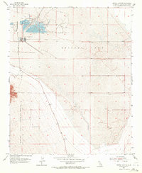
Salt Evaporators dominate the northwestern basin of Bristol Lake in this mid-1950s survey of the Mojave Desert. The map captures the industrial character of the dry lake bed, where brine management and salt harvesting defined the local activity near the southern edge of the Cadiz valley. Along the western margin, the terrain rises sharply into the foothills, where the Marine Corps Training Center boundary is clearly delineated. Transport across this arid stretch is facilitated by the Amboy Road, which cuts diagonally toward the higher ground. Numerous small markings for Prospects and Gravel Pits are scattered across the alluvial fans, indicating a landscape defined by both military presence and mineral extraction.
Find a feature on this map
7 named features on this map. Tap any name to fly to it.
Don’t see what you’re looking for? This feature index may not catch every label — zoom into the map to look around manually.
Map Details
Editions of this 1954 Bristol Lake NW Map
4 editions found
Other maps of this area

1942 · Amboy
USGS Topo · 1:250,000

1943 · Amboy
USGS Topo · 1:250,000

1954 · Needles
USGS Topo · 1:250,000

1954 · Amboy Crater
USGS Topo · 1:24,000

1954 · Bristol Lake SW
USGS Topo · 1:24,000

1955 · Lead Mtn. NE
USGS Topo · 1:24,000
1955 · Cleghorn Lakes
USGS Topo · 1:24,000

1955 · Lead Mountain
USGS Topo · 1:62,500

1956 · Needles
USGS Topo · 1:250,000

1956 · Bristol Lake
USGS Topo · 1:62,500