
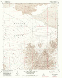
1955 Map of Lead Mtn. NE
USGS Topo · Published 1955About this map
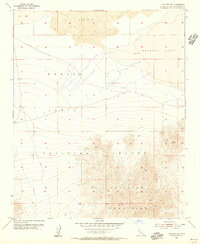
Marine Corps Training Center lands dominate this mid-century survey, illustrating the intersection of military operations and the unforgiving Mojave Desert. The landscape is defined by stark geological transitions, from the extensive Lava flows in the north to the elevations of the Bullion Mountains in the south. Between these features lie the alkaline flats of Bristol Lake and a smaller Dry Lake, suggesting a terrain where water is transient and precious. Human activity is sparse but notable, primarily centered on small-scale extraction and survival. The presence of the American Mine, a localized Shaft, and a Dry Well highlights the region's mining history, while a solitary Jeep Trail provides the only recorded passage through the training grounds. Geodetic markers like East Bull VABM 1933 and Bull VABM 3566 serve as the primary navigational anchors in this austere environment.
Find a feature on this map
11 named features on this map. Tap any name to fly to it.
Don’t see what you’re looking for? This feature index may not catch every label — zoom into the map to look around manually.
Map Details
Editions of this 1955 Lead Mtn. NE Map
6 editions found
Other maps of this area

1942 · Amboy
USGS Topo · 1:250,000

1943 · Amboy
USGS Topo · 1:250,000

1954 · Needles
USGS Topo · 1:250,000

1954 · Bristol Lake NW
USGS Topo · 1:24,000

1954 · Amboy Crater
USGS Topo · 1:24,000

1954 · Bagdad SW
USGS Topo · 1:24,000

1954 · Bristol Lake SW
USGS Topo · 1:24,000

1955 · Lead Mountain
USGS Topo · 1:24,000

1955 · Lead Mountain SW
USGS Topo · 1:24,000
1955 · Cleghorn Lakes
USGS Topo · 1:24,000