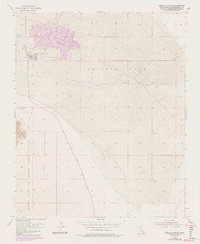
1954 Map of Bristol Lake NW
USGS Topo · Published 1985About this map
Bristol Lake dominates this arid landscape, characterized by the expansive Salt Evaporators in its northern basin. These geometric industrial works reflect the mid-century extraction of minerals from the dry lake bed, a practice central to the region's desert economy. To the southwest, the boundary of the Marine Corps Air Ground Combat Center encroaches upon the alluvial fans, marking a shift in land use toward military operations that would define the area's modern character. Moving through the center of the sheet, Amboy Road serves as the primary artery for transportation, flanked by scattered mining activity including several Prospect and Prospects sites. The contrast between the industrial scale of the salt pans and the isolated mineral exploration at the base of the surrounding slopes illustrates the diverse ways the San Bernardino desert has been utilized for its resources.
Find a feature on this map
7 named features on this map. Tap any name to fly to it.
Don’t see what you’re looking for? This feature index may not catch every label — zoom into the map to look around manually.
Map Details
Editions of this 1954 Bristol Lake NW Map
4 editions found
Other maps of this area

1942 · Amboy
USGS Topo · 1:250,000

1943 · Amboy
USGS Topo · 1:250,000

1954 · Needles
USGS Topo · 1:250,000

1954 · Bristol Lake NW
USGS Topo · 1:24,000

1954 · Amboy Crater
USGS Topo · 1:24,000

1954 · Bristol Lake SW
USGS Topo · 1:24,000

1955 · Lead Mtn. NE
USGS Topo · 1:24,000
1955 · Cleghorn Lakes
USGS Topo · 1:24,000

1955 · Lead Mountain
USGS Topo · 1:62,500

1956 · Needles
USGS Topo · 1:250,000