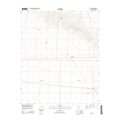
2015 Map of Cadiz
USGS Topo · Published 2015About this map
The Marble Mountains dominate the northern landscape of this Mojave quadrangle, their steep contours descending into the open expanse of the Mojave Desert. The sparse settlement of Chambless sits along a desert corridor defined by Moneta Rd and Mac Tul Rd, serving as a remote outpost in San Bernardino County. To the southeast, the small community of Cadiz marks a critical junction where the local transportation network meets the Cadiz Airstrip. The environment is shaped by intermittent drainage patterns, including Cuts Wash, which navigate the arid terrain between the mountain slopes and the low-lying desert floor. Surveyed in the modern era, the map captures the isolation and functional layout of these desert waypoints, showing how roads like Cadiz Rd connect these distant points of habitation and infrastructure.
Find a feature on this map
13 named features on this map. Tap any name to fly to it.
Don’t see what you’re looking for? This feature index may not catch every label — zoom into the map to look around manually.
Map Details
Editions of this 2015 Cadiz Map
This is the sole edition of this map. No revisions or reprints were ever made.
Other maps of this area

1942 · Amboy
USGS Topo · 1:250,000

1943 · Amboy
USGS Topo · 1:250,000

1943 · Danby
USGS Topo · 1:62,500

1943 · Cadiz Lake
USGS Topo · 1:62,500

1954 · Needles
USGS Topo · 1:250,000

1954 · Bristol Lake NW
USGS Topo · 1:24,000

1956 · Needles
USGS Topo · 1:250,000

1956 · Bristol Lake
USGS Topo · 1:62,500

1956 · Cadiz Lake
USGS Topo · 1:62,500

1956 · Cadiz
USGS Topo · 1:62,500