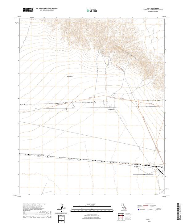
2021 Map of Cadiz
USGS Topo · Published 2021About this map
Cadiz and Chambless anchor this desert landscape within the Mojave Desert, marking significant points of human activity in the arid expanse of San Bernardino County. The topography is dominated by the Marble Mountains, which rise sharply to the north, overlooking the broad basins of Cadiz Valley and Fenner Valley. The mapping of this area reveals a network of primitive routes and trails such as Ns323 Trl and Ns327 Trl that cut through the valley floor, alongside established corridors like Cadiz Rd and Sweet Wind Rd. A notable aviation feature, the Cadiz Airstrip, sits south of the main rail line, reflecting the logistical importance of these remote desert outposts. The township and range lines, including t6n r14e, provide a structured grid over a terrain defined by alluvial washes and ancient mountain ridges.
Find a feature on this map
19 named features on this map. Tap any name to fly to it.
Don’t see what you’re looking for? This feature index may not catch every label — zoom into the map to look around manually.
Map Details
Editions of this 2021 Cadiz Map
This is the sole edition of this map. No revisions or reprints were ever made.
Other maps of this area

1942 · Amboy
USGS Topo · 1:250,000

1943 · Amboy
USGS Topo · 1:250,000

1943 · Danby
USGS Topo · 1:62,500

1943 · Cadiz Lake
USGS Topo · 1:62,500

1954 · Needles
USGS Topo · 1:250,000

1954 · Bristol Lake NW
USGS Topo · 1:24,000

1956 · Needles
USGS Topo · 1:250,000

1956 · Bristol Lake
USGS Topo · 1:62,500

1956 · Cadiz Lake
USGS Topo · 1:62,500

1956 · Cadiz
USGS Topo · 1:62,500