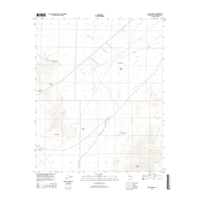
2015 Map of Cadiz Summit
USGS Topo · Published 2015About this map
The Marble Mountains rise sharply in the western section of this desert landscape, framing the high point at Cadiz Summit. This arid region in San Bernardino County is defined by the sweeping expanse of the Mojave Desert and the wide drainage of Watson Wash, which cuts a path toward the Fenner Valley. The small settlement of Cadiz is situated along the southern edge of the survey, connected to the broader region by Cadiz Rd. To the southeast, the slopes of the Ship Mountains emerge, marking the topographic transition between these valley floors and the higher mountain ranges. The arrangement of these landforms illustrates the characteristic basin and range structure of the California desert, where isolated massifs are separated by vast alluvial plains and seasonal watercourses.
Find a feature on this map
12 named features on this map. Tap any name to fly to it.
Don’t see what you’re looking for? This feature index may not catch every label — zoom into the map to look around manually.
Map Details
Editions of this 2015 Cadiz Summit Map
This is the sole edition of this map. No revisions or reprints were ever made.
Other maps of this area

1942 · Amboy
USGS Topo · 1:250,000

1943 · Amboy
USGS Topo · 1:250,000

1943 · Danby
USGS Topo · 1:62,500

1943 · Cadiz Lake
USGS Topo · 1:62,500

1954 · Needles
USGS Topo · 1:250,000

1956 · Needles
USGS Topo · 1:250,000

1956 · Bristol Lake
USGS Topo · 1:62,500

1956 · Cadiz Lake
USGS Topo · 1:62,500

1956 · Cadiz
USGS Topo · 1:62,500

1956 · Danby
USGS Topo · 1:62,500