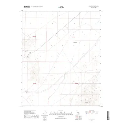
2018 Map of Cadiz Summit
USGS Topo · Published 2018About this map
Cadiz Summit serves as a critical geographic transition point between the Marble Mountains and the Ship Mountains, marking a pass through this arid landscape. The map illustrates the convergence of several major landforms, where the high desert terrain of the Mojave Desert drops into the broad alluvial expanses of Fenner Valley and Cadiz Valley. Settlement is sparse, anchored by the tiny outpost of Cadiz in the southwest, while the desert floor is carved by ephemeral drainage systems like Watson Wash and Vulcan Wash. The prominence of Cadiz Rd as the primary transit corridor highlights the historical importance of this route for crossing the desert long before modern interstates dominated the region. This 2018 survey provides a precise view of the topography and township boundaries, including t6n r14e and t5n-r15e, which define the administrative grid of this San Bernardino County wilderness.
Find a feature on this map
14 named features on this map. Tap any name to fly to it.
Don’t see what you’re looking for? This feature index may not catch every label — zoom into the map to look around manually.
Map Details
Editions of this 2018 Cadiz Summit Map
This is the sole edition of this map. No revisions or reprints were ever made.
Other maps of this area

1942 · Amboy
USGS Topo · 1:250,000

1943 · Amboy
USGS Topo · 1:250,000

1943 · Danby
USGS Topo · 1:62,500

1943 · Cadiz Lake
USGS Topo · 1:62,500

1954 · Needles
USGS Topo · 1:250,000

1956 · Needles
USGS Topo · 1:250,000

1956 · Bristol Lake
USGS Topo · 1:62,500

1956 · Cadiz Lake
USGS Topo · 1:62,500

1956 · Cadiz
USGS Topo · 1:62,500

1956 · Danby
USGS Topo · 1:62,500