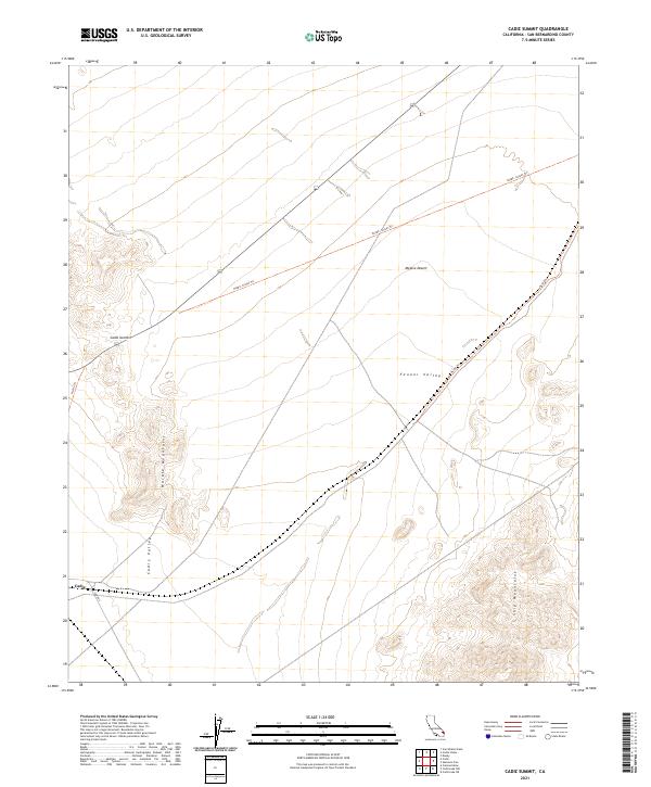
2021 Map of Cadiz Summit
USGS Topo · Published 2021About this map
Cadiz Summit stands as a focal point in this 2021 survey, situated along the historic path of Highway 66 as it cuts through the high desert of San Bernardino County. The topography is defined by the stark transition between the alluvial basins of Cadiz Valley and Fenner Valley and the uplifted terrain of the Marble Mountains and Ship Mountains. This modern data capture reflects the enduring layout of the eastern Mojave Desert, where essential transportation corridors follow natural passes.
Find a feature on this map
16 named features on this map. Tap any name to fly to it.
Don’t see what you’re looking for? This feature index may not catch every label — zoom into the map to look around manually.
Map Details
Editions of this 2021 Cadiz Summit Map
This is the sole edition of this map. No revisions or reprints were ever made.
Other maps of this area

1942 · Amboy
USGS Topo · 1:250,000

1943 · Amboy
USGS Topo · 1:250,000

1943 · Danby
USGS Topo · 1:62,500

1943 · Cadiz Lake
USGS Topo · 1:62,500

1954 · Needles
USGS Topo · 1:250,000

1956 · Needles
USGS Topo · 1:250,000

1956 · Bristol Lake
USGS Topo · 1:62,500

1956 · Cadiz Lake
USGS Topo · 1:62,500

1956 · Cadiz
USGS Topo · 1:62,500

1956 · Danby
USGS Topo · 1:62,500