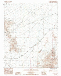
1985 Map of Cadiz Summit
USGS Topo · Published 1985About this map
The Atchison Topeka And Santa Fe railroad cuts a diagonal path across this desert landscape, linking the small outposts of Cadiz Summit, Siam (Site), and Cadiz. This mid-1980s landscape is defined by its industrial and transit infrastructure, including a prominent Pipeline and an extensive system of Levees designed to manage runoff through the desert washes.
Find a feature on this map
16 named features on this map. Tap any name to fly to it.
Don’t see what you’re looking for? This feature index may not catch every label — zoom into the map to look around manually.
Map Details
Editions of this 1985 Cadiz Summit Map
This is the sole edition of this map. No revisions or reprints were ever made.
Other maps of this area

1942 · Amboy
USGS Topo · 1:250,000

1943 · Amboy
USGS Topo · 1:250,000

1943 · Danby
USGS Topo · 1:62,500

1943 · Cadiz Lake
USGS Topo · 1:62,500

1954 · Needles
USGS Topo · 1:250,000

1956 · Needles
USGS Topo · 1:250,000

1956 · Bristol Lake
USGS Topo · 1:62,500

1956 · Cadiz Lake
USGS Topo · 1:62,500

1956 · Cadiz
USGS Topo · 1:62,500

1956 · Danby
USGS Topo · 1:62,500