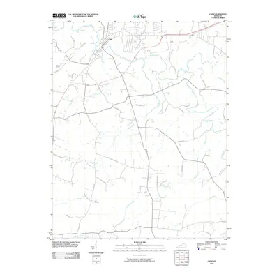
2010 Map of Cadiz
USGS Topo · Published 2010About this map
Cadiz serves as the focal point of this Western Kentucky landscape, situated along the winding course of the Little River. The area's topography is defined by a dense network of tributaries including Burge Creek, Sinking Fork, and Donaldson Creek, which carve through the terrain near landmarks like Coyote Ridge Rd. The map illustrates a rural infrastructure centered on family and community history, with road names that point to long-standing local lineages and vanished landmarks.
Find a feature on this map
43 named features on this map. Tap any name to fly to it.
Don’t see what you’re looking for? This feature index may not catch every label — zoom into the map to look around manually.
Map Details
Editions of this 2010 Cadiz Map
This is the sole edition of this map. No revisions or reprints were ever made.
Other maps of this area

1950 · Caledonia
USGS Topo · 1:24,000

1951 · Caledonia
USGS Topo · 1:24,000

1951 · Model
USGS Topo · 1:24,000

1951 · Roaring Spring
USGS Topo · 1:24,000

1951 · Johnson Hollow
USGS Topo · 1:24,000

1953 · Canton
USGS Topo · 1:24,000

1953 · Gracey
USGS Topo · 1:24,000

1953 · Cobb
USGS Topo · 1:24,000
1953 · Lamasco
USGS Topo · 1:24,000
1953 · Cadiz
USGS Topo · 1:24,000