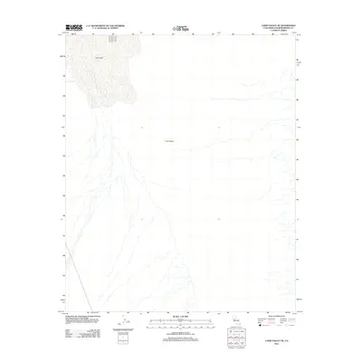
2012 Map of Cadiz Valley NE
USGS Topo · Published 2012About this map
Cadiz Lake dominates the northern landscape of this San Bernardino County survey, where the dry playa bed meets the expansive arid flats of the Cadiz Valley. The terrain is characterized by a complex network of ephemeral wash patterns that drain from the south and east toward the lake bed, illustrating the hydrological signature of the Mojave Desert. This 2012 topographic study, produced by the U.S. Geological Survey, provides a detailed record of these natural drainage features and the subtle elevation changes of the desert floor during a period of modern environmental observation. The lack of built infrastructure or settlements within this quadrangle emphasizes the geological and topographical isolation of the valley, making it a distinct reference for researchers studying desert landforms and shifting drainage corridors.
Find a feature on this map
2 named features on this map. Tap any name to fly to it.
Don’t see what you’re looking for? This feature index may not catch every label — zoom into the map to look around manually.
Map Details
Editions of this 2012 Cadiz Valley NE Map
This is the sole edition of this map. No revisions or reprints were ever made.
Other maps of this area

1942 · Amboy
USGS Topo · 1:250,000

1943 · Amboy
USGS Topo · 1:250,000

1943 · Cadiz Lake
USGS Topo · 1:62,500

1943 · Cadiz Valley
USGS Topo · 1:62,500

1943 · Iron Mountains
USGS Topo · 1:62,500

1954 · Needles
USGS Topo · 1:250,000

1956 · Needles
USGS Topo · 1:250,000

1956 · Milligan
USGS Topo · 1:62,500

1956 · Iron Mountains
USGS Topo · 1:62,500

1956 · Cadiz Lake
USGS Topo · 1:62,500