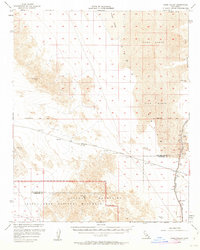
1956 Map of Cadiz Valley
USGS Topo · Published 1963About this map
Joshua Tree National Monument anchors the southwest corner of this mid-century survey, where the Coxcomb Mountains rise sharply above the Pinto Basin. The landscape is defined by its engineering and desert geography, specifically the prominent route of the Colorado River Aqueduct and its associated siphons and levees as it cuts through the valley. This infrastructure was critical for transporting water across the arid interior to coastal basins.
Find a feature on this map
21 named features on this map. Tap any name to fly to it.
Don’t see what you’re looking for? This feature index may not catch every label — zoom into the map to look around manually.
Map Details
Editions of this 1956 Cadiz Valley Map
3 editions found
Other maps of this area

1942 · Amboy
USGS Topo · 1:250,000

1943 · Amboy
USGS Topo · 1:250,000

1943 · Cadiz Lake
USGS Topo · 1:62,500

1943 · Cadiz Valley
USGS Topo · 1:62,500

1943 · Iron Mountains
USGS Topo · 1:62,500

1943 · Coxcomb Mountains
USGS Topo · 1:62,500

1944 · Eagle Tank
USGS Topo · 1:62,500

1944 · Coxcomb Mountains
USGS Topo · 1:62,500

1952 · Palen Mountains
USGS Topo · 1:62,500

1954 · Salton Sea
USGS Topo · 1:250,000