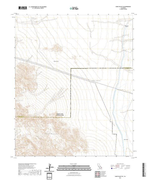
2021 Map of Cadiz Valley SE
USGS Topo · Published 2021About this map
Joshua Tree National Park spans the southern portion of this landscape, where the high peaks of the Coxcomb Mountains rise sharply from the desert floor. This area of the Mojave Desert is defined by its vast alluvial plains and the critical infrastructure of the Colorado River Aqueduct, which cuts a straight line across the Cadiz Valley before entering the mountains near the West Iron Portal. The map illustrates the convergence of San Bernardino and Riverside counties, capturing the transition from the broad, sandy reaches of the Palen Valley to the rugged granite ridges that form a natural boundary. The engineering required to transport water through such arid terrain is evident in the aqueduct's precise path, which bypasses the natural contours of the desert flats to reach its mountain transit point.
Find a feature on this map
14 named features on this map. Tap any name to fly to it.
Don’t see what you’re looking for? This feature index may not catch every label — zoom into the map to look around manually.
Map Details
Editions of this 2021 Cadiz Valley SE Map
This is the sole edition of this map. No revisions or reprints were ever made.
Other maps of this area

1942 · Amboy
USGS Topo · 1:250,000

1943 · Amboy
USGS Topo · 1:250,000

1943 · Cadiz Valley
USGS Topo · 1:62,500

1943 · Iron Mountains
USGS Topo · 1:62,500

1943 · Coxcomb Mountains
USGS Topo · 1:62,500

1944 · Coxcomb Mountains
USGS Topo · 1:62,500

1952 · Palen Mountains
USGS Topo · 1:62,500

1954 · Salton Sea
USGS Topo · 1:250,000

1954 · Needles
USGS Topo · 1:250,000

1955 · Salton Sea
USGS Topo · 1:250,000