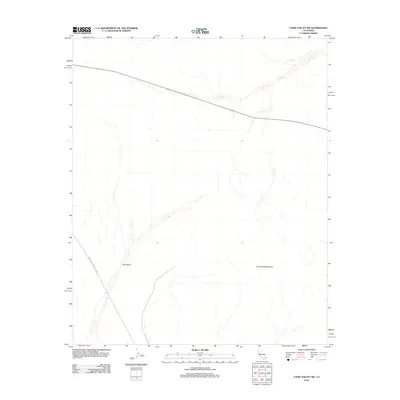
2012 Map of Cadiz Valley SW
USGS Topo · Published 2012About this map
Joshua Tree National Park boundaries extend into this desert landscape, where the high desert terrain of the Pinto Basin meets the stark rising slopes of the Coxcomb Mountains. This 2012 survey illustrates a transition point in the Mojave Desert, defined largely by natural drainage patterns and the path of Highway 62, which cuts across the northern reaches of the quadrangle. The map captures the interface between protected federal lands and the open desert of San Bernardino County, showcasing the vast alluvial fans and dry washes that characterize this portion of the Cadiz Valley before it reaches the dry lake beds further north.
Find a feature on this map
4 named features on this map. Tap any name to fly to it.
Don’t see what you’re looking for? This feature index may not catch every label — zoom into the map to look around manually.
Map Details
Editions of this 2012 Cadiz Valley SW Map
This is the sole edition of this map. No revisions or reprints were ever made.
Other maps of this area

1942 · Amboy
USGS Topo · 1:250,000

1943 · Amboy
USGS Topo · 1:250,000

1943 · Cadiz Valley
USGS Topo · 1:62,500

1943 · Coxcomb Mountains
USGS Topo · 1:62,500

1944 · Eagle Tank
USGS Topo · 1:62,500

1944 · Coxcomb Mountains
USGS Topo · 1:62,500

1954 · Salton Sea
USGS Topo · 1:250,000

1954 · Needles
USGS Topo · 1:250,000

1955 · Salton Sea
USGS Topo · 1:250,000

1956 · Needles
USGS Topo · 1:250,000