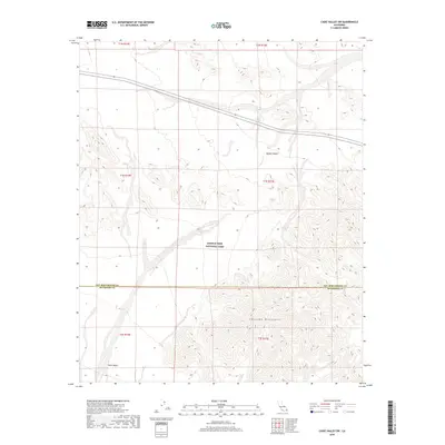
2018 Map of Cadiz Valley SW
USGS Topo · Published 2018About this map
Joshua Tree National Park spans the central and southern portions of this desert landscape, where the northern reaches of the Pinto Basin meet the steep topography of the Coxcomb Mountains. The map documents a stark transition between the low-lying basin floor and the high ridgelines that define the park’s eastern boundary. The San Bernardino and Riverside county line bisects the quadrangle, providing a precise reference for those researching land ownership or jurisdictional history in this remote section of the California desert. The northern area is dominated by the wide expanse of the Mojave Desert, where Highway 62 serves as the primary corridor through the arid terrain. The lack of modern development emphasizes the natural drainage patterns and alluvial fans radiating from the mountain slopes into the basin.
Find a feature on this map
12 named features on this map. Tap any name to fly to it.
Don’t see what you’re looking for? This feature index may not catch every label — zoom into the map to look around manually.
Map Details
Editions of this 2018 Cadiz Valley SW Map
This is the sole edition of this map. No revisions or reprints were ever made.
Other maps of this area

1942 · Amboy
USGS Topo · 1:250,000

1943 · Amboy
USGS Topo · 1:250,000

1943 · Cadiz Valley
USGS Topo · 1:62,500

1943 · Coxcomb Mountains
USGS Topo · 1:62,500

1944 · Eagle Tank
USGS Topo · 1:62,500

1944 · Coxcomb Mountains
USGS Topo · 1:62,500

1954 · Salton Sea
USGS Topo · 1:250,000

1954 · Needles
USGS Topo · 1:250,000

1955 · Salton Sea
USGS Topo · 1:250,000

1956 · Needles
USGS Topo · 1:250,000