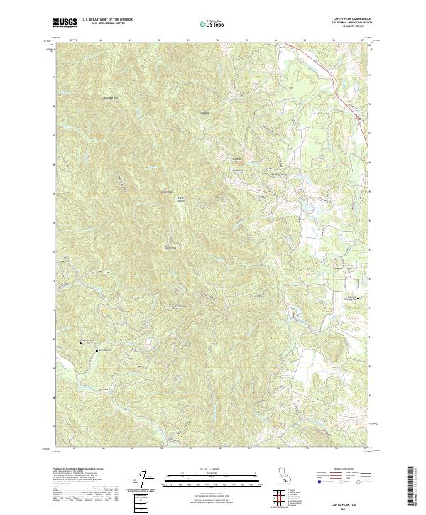
2021 Map of Cahto Peak
USGS Topo · Published 2021About this map
Cahto Peak and Signal Peak dominate this portion of the Mendocino Range, where the headwaters of the S Fork Eel River and Tenmile Cr carve through the heavily ridged terrain. This modern survey illustrates the complex drainage patterns of the area, featuring named watercourses like Misery Cr, Grapevine Cr, and Cahto Cr. For genealogists and local historians, the map is particularly valuable for its placement of rural burial grounds, including the Laytonville Rancheria Cem on the eastern edge and the Branscomb Cem further west near Buck Cr. The landscape is a mix of high-elevation points like Black Oak Mtn and significant clearings or gaps such as Stoten Opening. Transportation is defined by winding mountain routes like Branscomb Rd and Kenny Creek Rd, which provide access to the various canyons and creeks that feed the Eel River system.
Find a feature on this map
70 named features on this map. Tap any name to fly to it.
Don’t see what you’re looking for? This feature index may not catch every label — zoom into the map to look around manually.
Map Details
Editions of this 2021 Cahto Peak Map
This is the sole edition of this map. No revisions or reprints were ever made.
Other maps of this area

1920 · Cummings
USGS Topo · 1:62,500

1920 · Covelo
USGS Topo · 1:62,500

1921 · Branscomb
USGS Topo · 1:62,500

1951 · Branscomb
USGS Topo · 1:62,500

1951 · Laytonville
USGS Topo · 1:62,500

1952 · Spyrock
USGS Topo · 1:62,500

1952 · Leggett
USGS Topo · 1:62,500

1957 · Ukiah
USGS Topo · 1:250,000

1960 · Ukiah
USGS Topo · 1:250,000
1966 · Dutchmans Knoll
USGS Topo · 1:24,000