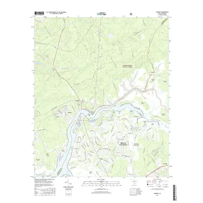
2017 Map of Cainhoy
USGS Topo · Published 2017About this map
The Wando River serves as the central artery for this coastal South Carolina landscape, dividing the northern reaches of Mount Pleasant from the dense woodlands of the Francis Marion National Forest. The map documents a blend of rapid suburban development and deep-rooted local history, where modern neighborhoods like Philip and the residential clusters around Rivertowne Country Club Dr sit near long-established sites. Genealogists can identify several historic burial grounds including Saint Thomas Cem, McDowell Cem, and Nelliefield Creek Cem. The transition from the rural crossroads at Cainhoy and Wando to the specialized infrastructure of the Mt Pleasant Regional Airport-Falson Field illustrates the changing character of the Lowcountry. Numerous tidal waterways, such as Horlbeck Creek and Guerin Creek, carve through a network of islands including Juba Island and Goat Island.
Find a feature on this map
153 named features on this map. Tap any name to fly to it.
Don’t see what you’re looking for? This feature index may not catch every label — zoom into the map to look around manually.
Map Details
Editions of this 2017 Cainhoy Map
This is the sole edition of this map. No revisions or reprints were ever made.
Other maps of this area

1919 · Capers Island
USGS Topo · 1:21,120

1919 · Wando
USGS Topo · 1:21,120

1919 · Cordesville
USGS Topo · 1:48,000

1919 · Melgrove
USGS Topo · 1:21,120

1919 · Charleston
USGS Topo · 1:21,120

1919 · Fort Moultrie
USGS Topo · 1:21,120

1919 · Sewee Bay
USGS Topo · 1:21,120

1940 · Melgrove
USGS Topo · 1:24,000

1943 · Capers Island
USGS Topo · 1:24,000

1943 · Fort Moultrie
USGS Topo · 1:24,000