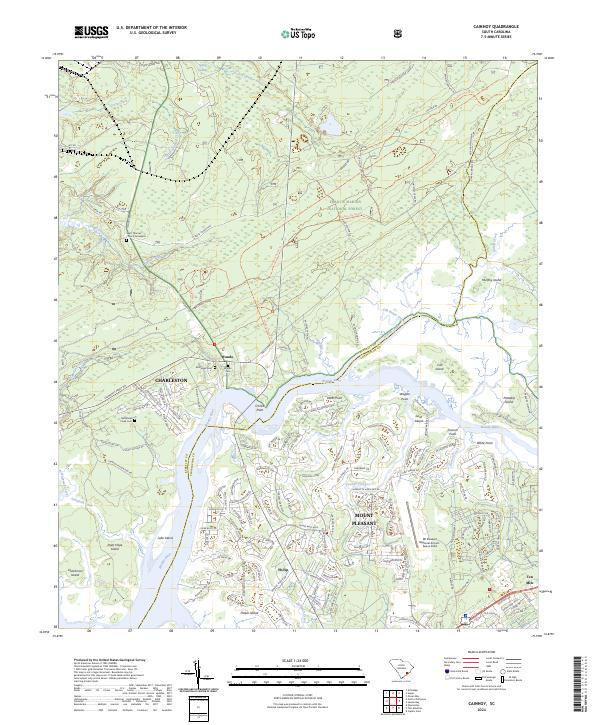
2024 Map of Cainhoy
USGS Topo · Published 2024About this map
The Wando River flows through this low-country landscape, where the modern expansion of Charleston and Mount Pleasant meets the protected reaches of the Francis Marion National Forest. The transition from suburban development to tidal wetlands is visible along the intricate network of creeks like French Quarter Creek and Toomer Creek. Local history is anchored by several burial grounds, including the Saint Thomas Church Graveyard and Nelliefield Creek Cem, which sit amidst newer residential subdivisions such as those near Philip. The map illustrates a landscape shaped by both its maritime geography—with numerous points and islands like Darts Point and Cat Island—and its modern infrastructure, including the Mt Pleasant Regional Airport-Faison Field and the thoroughfares of Clements Ferry Rd and Cainhoy Rd.
Find a feature on this map
164 named features on this map. Tap any name to fly to it.
Don’t see what you’re looking for? This feature index may not catch every label — zoom into the map to look around manually.
Map Details
Editions of this 2024 Cainhoy Map
This is the sole edition of this map. No revisions or reprints were ever made.
Other maps of this area

1919 · Capers Island
USGS Topo · 1:21,120

1919 · Wando
USGS Topo · 1:21,120

1919 · Cordesville
USGS Topo · 1:48,000

1919 · Melgrove
USGS Topo · 1:21,120

1919 · Charleston
USGS Topo · 1:21,120

1919 · Fort Moultrie
USGS Topo · 1:21,120

1919 · Sewee Bay
USGS Topo · 1:21,120

1940 · Melgrove
USGS Topo · 1:24,000

1943 · Capers Island
USGS Topo · 1:24,000

1943 · Fort Moultrie
USGS Topo · 1:24,000