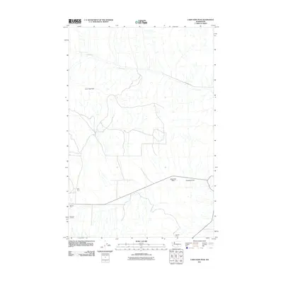
2011 Map of Cairn Hope Peak
USGS Topo · Published 2011About this map
Black Rock Cemetery sits near the southwestern corner of this Yakima County landscape, marking a quiet point of local history amidst a terrain of high-desert basins and ridges. This 2011 survey illustrates a sparse ranching environment where large landholdings like Taylor Ranch, Meeboer Ranch, and Beynaud Ranch are the primary markers of human settlement. The geography is dominated by the broad Black Rock Valley and the prominent rising of Cairn Hope Peak to the northwest. Modern infrastructure is represented by Cold Creek Rd, which follows the drainage of Cold Creek through the northern hills. The map provides a clear picture of the arid Washington interior, where topographic features like Horsethief Point and isolated ranch houses define the distance between neighbors and the specific routes taken through this open country.
Find a feature on this map
9 named features on this map. Tap any name to fly to it.
Don’t see what you’re looking for? This feature index may not catch every label — zoom into the map to look around manually.
Map Details
Editions of this 2011 Cairn Hope Peak Map
This is the sole edition of this map. No revisions or reprints were ever made.
Other maps of this area

1910 · Zillah
USGS Topo · 1:125,000

1915 · Prosser
USGS Topo · 1:125,000

1917 · Priest Rapids
USGS Topo · 1:62,500

1917 · Prosser
USGS Topo · 1:125,000

1936 · Hog Ranch Buttes
USGS Topo · 1:48,000

1941 · Black Rock Spring
USGS Topo · 1:62,500

1948 · Cairn Hope Peak
USGS Topo · 1:24,000

1948 · Emerson Nipple
USGS Topo · 1:24,000

1948 · Priest Rapids
USGS Topo · 1:24,000

1950 · Yakima
USGS Topo · 1:250,000