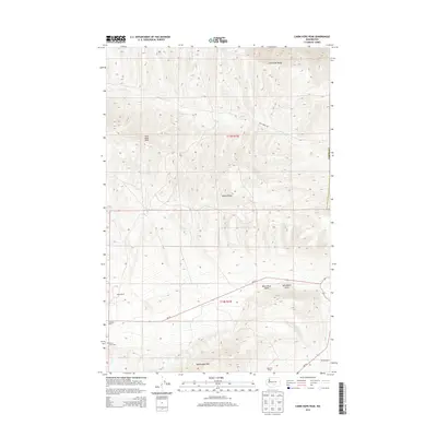
2014 Map of Cairn Hope Peak
USGS Topo · Published 2014About this map
Yakima Ridge and the Rattlesnake Hills define this high-desert corridor of eastern Washington, where the landscape is marked by the parallel ridges of the Yakima Fold Belt. The map illustrates a sparse, ranching-oriented settlement pattern centered around family-named landmarks like Taylor Ranch and Meeboer Ranch. In the southeast corner, Black Rock Valley sits below Horsethief Point, providing a pocket of lower elevation between the heights of Cairn Hope Peak and Umtanum Ridge. Transportation is limited to narrow arteries like Wa-24 and Cold Creek Rd, reflecting the region's historical reliance on remote road networks to connect isolated agricultural outposts. For those tracing local history, the Black Rock Cem stands as a significant point of interest in this arid and windswept terrain.
Find a feature on this map
18 named features on this map. Tap any name to fly to it.
Don’t see what you’re looking for? This feature index may not catch every label — zoom into the map to look around manually.
Map Details
Editions of this 2014 Cairn Hope Peak Map
This is the sole edition of this map. No revisions or reprints were ever made.
Other maps of this area

1910 · Zillah
USGS Topo · 1:125,000

1915 · Prosser
USGS Topo · 1:125,000

1917 · Priest Rapids
USGS Topo · 1:62,500

1917 · Prosser
USGS Topo · 1:125,000

1936 · Hog Ranch Buttes
USGS Topo · 1:48,000

1941 · Black Rock Spring
USGS Topo · 1:62,500

1948 · Cairn Hope Peak
USGS Topo · 1:24,000

1948 · Emerson Nipple
USGS Topo · 1:24,000

1948 · Priest Rapids
USGS Topo · 1:24,000

1950 · Yakima
USGS Topo · 1:250,000