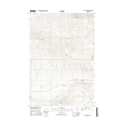
2017 Map of Cairn Hope Peak
USGS Topo · Published 2017About this map
Umtanum Ridge and Yakima Ridge define the high-altitude landscape of this central Washington territory, where deep valleys separate prominent basalt uplifts. The map reveals a transition from these ridges into the Black Rock Valley to the south, bounded by the Rattlesnake Hills. This area is characterized by vast stretches of open land with sparse infrastructure, centered around the drainage of Cold Cr. Human presence is marked primarily by small roads such as Cold Creek Rd and Filey Rd, which navigate the elevation changes between the peaks. A significant point for local history is the Black Rock Cem, situated in the southwestern corner, providing a tangible link to the early settlers who occupied these arid valleys long before modern development. The survey also identifies geological landmarks like Cairn Hope Peak and Horsethief Point, which have served as essential navigational markers in the high desert.
Find a feature on this map
14 named features on this map. Tap any name to fly to it.
Don’t see what you’re looking for? This feature index may not catch every label — zoom into the map to look around manually.
Map Details
Editions of this 2017 Cairn Hope Peak Map
This is the sole edition of this map. No revisions or reprints were ever made.
Other maps of this area

1910 · Zillah
USGS Topo · 1:125,000

1915 · Prosser
USGS Topo · 1:125,000

1917 · Priest Rapids
USGS Topo · 1:62,500

1917 · Prosser
USGS Topo · 1:125,000

1936 · Hog Ranch Buttes
USGS Topo · 1:48,000

1941 · Black Rock Spring
USGS Topo · 1:62,500

1948 · Cairn Hope Peak
USGS Topo · 1:24,000

1948 · Emerson Nipple
USGS Topo · 1:24,000

1948 · Priest Rapids
USGS Topo · 1:24,000

1950 · Yakima
USGS Topo · 1:250,000