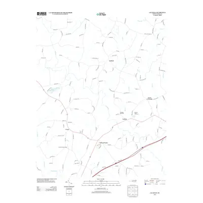
2013 Map of Calahaln
USGS Topo · Published 2013About this map
Calahaln Mountain rises as a prominent landmark in this portion of Davie County, overlooking a landscape defined by small rural hubs and the meandering course of Hunting Cr. The area is anchored by several distinct communities, including Ijames Crossroads, Sheffield, and Oakland Heights, reflecting the decentralized settlement patterns common in this part of North Carolina. To the south, the S Yadkin River forms a significant hydrological boundary, joined by tributaries such as Dutchman Cr and Little Cr. The presence of the Schneider Haven Airstrip and the Lake Myers Family Campground near Calahaln suggests a mix of private aviation and regional recreation. The road network, including family-named routes like Powell Bridge Rd and John Ijames Rd, provides a clear view of local land use and genealogical heritage.
Find a feature on this map
139 named features on this map. Tap any name to fly to it.
Don’t see what you’re looking for? This feature index may not catch every label — zoom into the map to look around manually.
Map Details
Editions of this 2013 Calahaln Map
This is the sole edition of this map. No revisions or reprints were ever made.
Other maps of this area

1891 · Yadkinville
USGS Topo · 1:125,000

1893 · Statesville
USGS Topo · 1:125,000

1893 · Yadkinville
USGS Topo · 1:125,000

1953 · Charlotte
USGS Topo · 1:250,000

1953 · Winston-Salem
USGS Topo · 1:250,000

1954 · Charlotte
USGS Topo · 1:250,000

1955 · Winston-Salem
USGS Topo · 1:250,000

1960 · Charlotte
USGS Topo · 1:250,000

1962 · Winston-Salem
USGS Topo · 1:250,000

1962 · Charlotte
USGS Topo · 1:250,000