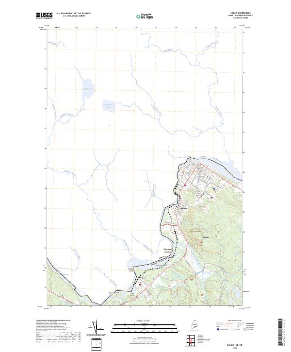
2024 Map of Calais
USGS Topo · Published 2024About this map
The St. Croix River serves as the international boundary between Calais and Canada, anchoring a landscape where industrial history meets modern conservation. The traditional street grid of the city, including thoroughfares like Main St and Calais Ave, leads toward the residential and commercial centers of Milltown and Saint Croix Junction. Notable local landmarks such as the Calais Cem and the Maine District Court - Calais provide essential reference points for genealogists and local historians tracking the civic development of this border community.
Find a feature on this map
62 named features on this map. Tap any name to fly to it.
Don’t see what you’re looking for? This feature index may not catch every label — zoom into the map to look around manually.
Map Details
Editions of this 2024 Calais Map
This is the sole edition of this map. No revisions or reprints were ever made.
Other maps of this area

1929 · Calais
USGS Topo · 1:48,000

1929 · Robbinston
USGS Topo · 1:48,000

1931 · Robbinston
USGS Topo · 1:62,500

1932 · Calais
USGS Topo · 1:62,500

1940 · Kellyland
USGS Topo · 1:62,500

1942 · Kellyland
USGS Topo · 1:62,500

1949 · Calais
USGS Topo · 1:24,000

1949 · Red Beach
USGS Topo · 1:24,000

1949 · Devils Head
USGS Topo · 1:24,000
1954 · Calais
USGS Topo · 1:25,000