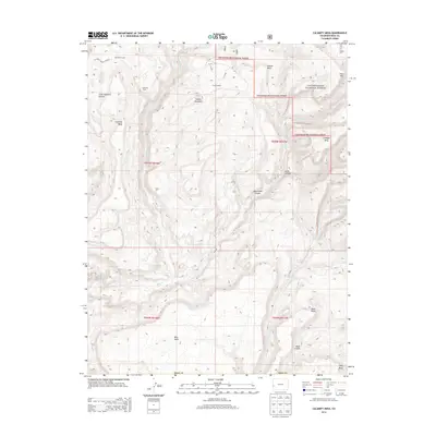
2013 Map of Calamity Mesa
USGS Topo · Published 2013About this map
The US Atomic Energy Reserve occupies the northwestern corner of this landscape, a reminder of the region's complex cold-war industrial history. This high plateau terrain in Mesa County is defined by a series of prominent flat-topped features, including Calamity Mesa, Outlaw Mesa, and Moon Mesa, which are dissected by deep drainages like Little Maverick Canyon and Blue Creek Canyon. Much of the eastern and northern portions of the map are protected within the Uncompahgre National Forest, where the terrain rises toward Potato Mountain and Pine Hill.
Find a feature on this map
31 named features on this map. Tap any name to fly to it.
Don’t see what you’re looking for? This feature index may not catch every label — zoom into the map to look around manually.
Map Details
Editions of this 2013 Calamity Mesa Map
This is the sole edition of this map. No revisions or reprints were ever made.
Other maps of this area

1916 · Paradox Valley
USGS Topo · 1:125,000

1922 · Paradox Valley
USGS Topo · 1:125,000

1948 · Roc Creek
USGS Topo · 1:24,000

1949 · Roc Creek
USGS Topo · 1:24,000

1949 · Juanita Arch
USGS Topo · 1:24,000

1949 · Atkinson Creek
USGS Topo · 1:24,000

1949 · Red Canyon
USGS Topo · 1:24,000

1949 · Calamity Mesa
USGS Topo · 1:24,000

1949 · Gateway
USGS Topo · 1:24,000

1950 · Juanita Arch
USGS Topo · 1:24,000