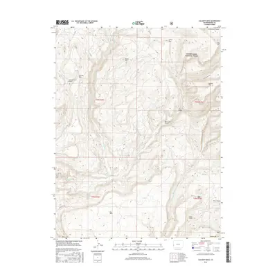
2016 Map of Calamity Mesa
USGS Topo · Published 2016About this map
The Uncompahgre Plateau dominates this portion of Mesa County, showing a deeply dissected landscape defined by high mesas and sheer canyon walls. Within the Uncompahgre National Forest, the terrain drops sharply from elevations like Potato Mtn into the winding depths of Blue Creek Canyon and Little Maverick Canyon. The map reveals a network of high-altitude roads and pathways, including the Franks Bench Trail and Blue Mesa Trail, which follow the contours of the land rather than a strict grid.
Find a feature on this map
31 named features on this map. Tap any name to fly to it.
Don’t see what you’re looking for? This feature index may not catch every label — zoom into the map to look around manually.
Map Details
Editions of this 2016 Calamity Mesa Map
This is the sole edition of this map. No revisions or reprints were ever made.
Other maps of this area

1916 · Paradox Valley
USGS Topo · 1:125,000

1922 · Paradox Valley
USGS Topo · 1:125,000

1948 · Roc Creek
USGS Topo · 1:24,000

1949 · Roc Creek
USGS Topo · 1:24,000

1949 · Juanita Arch
USGS Topo · 1:24,000

1949 · Atkinson Creek
USGS Topo · 1:24,000

1949 · Red Canyon
USGS Topo · 1:24,000

1949 · Calamity Mesa
USGS Topo · 1:24,000

1949 · Gateway
USGS Topo · 1:24,000

1950 · Juanita Arch
USGS Topo · 1:24,000