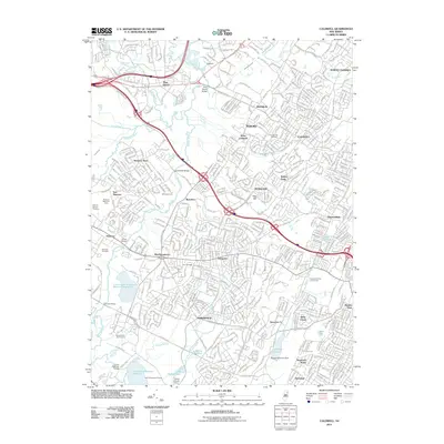
2011 Map of Caldwell
USGS Topo · Published 2011About this map
The Passaic River and its numerous tributaries, including Rockaway River, Whippany River, and Foulertons Brook, carve a complex drainage pattern across this suburban landscape. This 2011 survey documents the dense residential development and green spaces of Essex and Morris counties, where established communities like Caldwell, Roseland, and East Hanover are connected by a network of major thoroughfares such as Eisenhower Parkway and Bloomfield Avenue. Historical connectivity is visible through several named crossings like Swinefield Bridge, Cooks Bridge, and Columbia Bridge.
Find a feature on this map
62 named features on this map. Tap any name to fly to it.
Don’t see what you’re looking for? This feature index may not catch every label — zoom into the map to look around manually.
Map Details
Editions of this 2011 Caldwell Map
This is the sole edition of this map. No revisions or reprints were ever made.
Other maps of this area

1888 · Plainfield
USGS Topo · 1:62,500

1888 · Morristown
USGS Topo · 1:62,500

1888 · Paterson
USGS Topo · 1:62,500

1892 · Paterson
USGS Topo · 1:62,500

1893 · Plainfield
USGS Topo · 1:62,500

1894 · Morristown
USGS Topo · 1:62,500

1898 · Morristown
USGS Topo · 1:62,500

1898 · Plainfield
USGS Topo · 1:62,500

1898 · Staten Island
USGS Topo · 1:62,500

1898 · Paterson
USGS Topo · 1:62,500